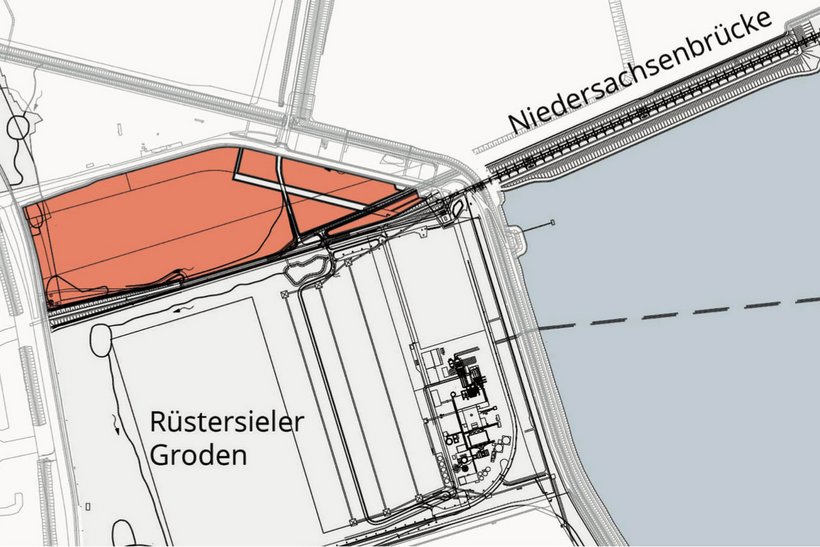
Commercial Area
Geniusbank

Address
Port Wilhelmshaven
Am tiefen Fahrwasser / Posener Straße
26388 Wilhelmshaven
Object
- total area of 24,5 ha
- commercial area in close proximity to the „Massenschüttgutterminal Niedersachsenbrücke“ and the container terminal CTW
- strategically well positioned, can be used in many ways
- areas partially covered with gravel
- subdividing possible
Availability / type of contract
- available on short notice
- lease or Erbpacht contract
Commercial utilization / zoning plan
- commercial and industrial uses
Land use and zoning plan / construction
- zoning plan 213
Limitations
- max. building height 45 m
Target businesses
- cargo handling driven settlements, port services, service companies
Road connection
- connection to Autobahn A 29 in immediate, close proximity
- federal motorway B 210 abt. 8 km
Rail connection
- rail access possible
- Sande 17 km
Quay facility
- Bulk Terminal Wilhelmshaven (BTW), seeward draft 19.5 m LAT
- distance abt. 2000 m
- landward draft 8.1 m LAT
Downloads
EU-Tender-Notice
Charcteristics
Object :
W04
Size :
24,5 ha
Buildings :
undeveloped surface
Availibility :
on short notice
Exploration :
undeveloped
Usage :
special port area
Distances
| Airport (Mariensiel) | abt. 12 km |
| City center Wilhelmshaven | abt. 10 km |
| Bremen | abt. 100 km |
| Bremerhaven | abt. 75 km |
| Hamburg | abt. 200 km |
| Hannover | abt. 220 km |
| Duisburg | abt. 340 km |
